Kākāpō Industries
Home
3D topographic models
Custom 3D models
For catchment groups
For regional councils
For GIS professionals
FAQs
Project gallery
Etsy Shop
About us
Contact us
Project gallery
Antarctica
3D model of the Antarctic continent, surrounding ice-shelves, and the Southern Ocean Bathymetry.
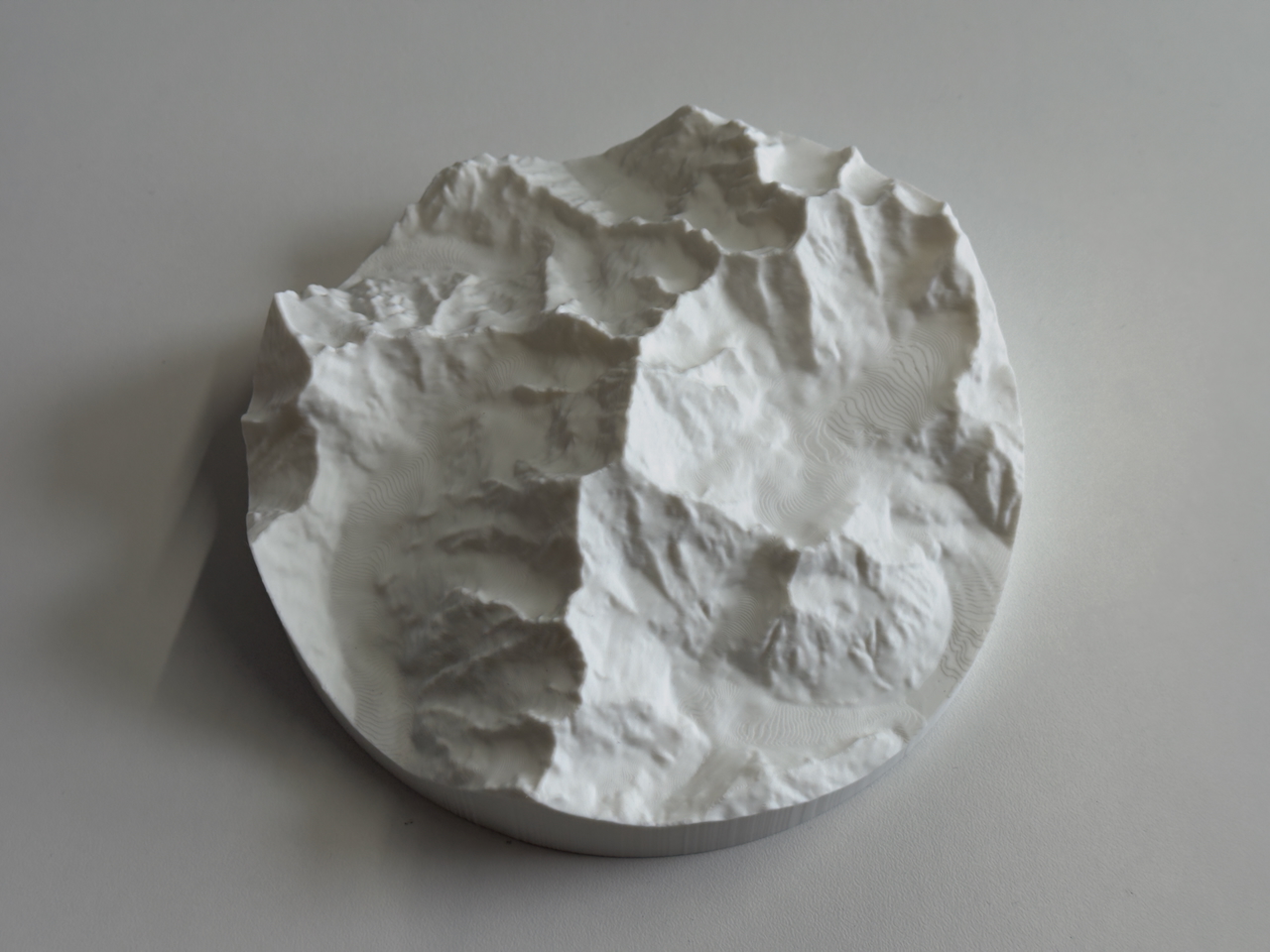
Aoraki / Mt Cook
This 3D model embodies New Zealand’s tallest mountain - Aoraki / Mt Cook.
Arctic
A complementary pairing to the Antarctica model, this 3D topo/bathy model displays the Arctic north.
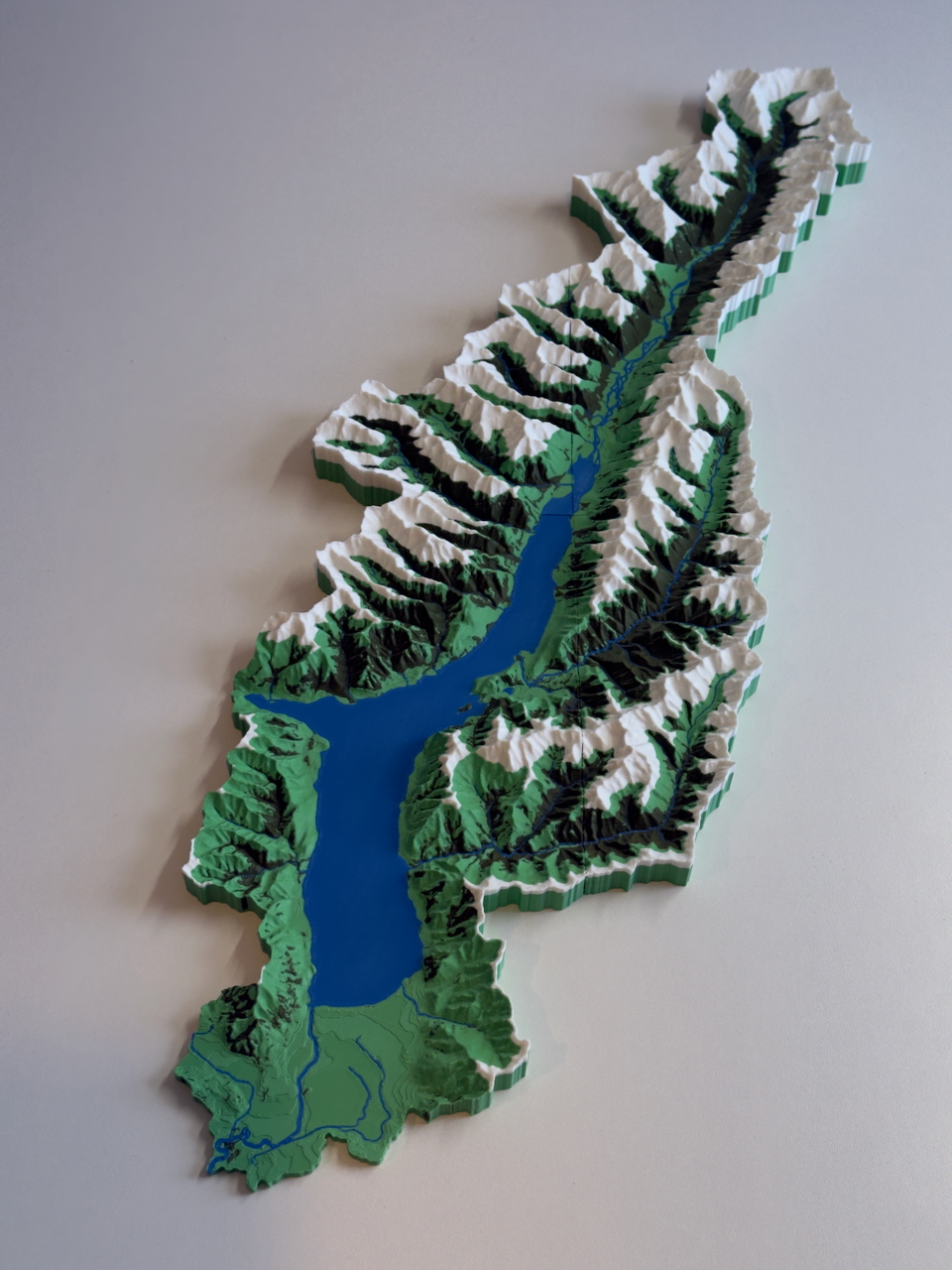
Lake Hawea
Stunning 3D catchment model of the Lake Hawea catchment, four colours highlighting the braided rivers, lake, native vegetation and snowline.
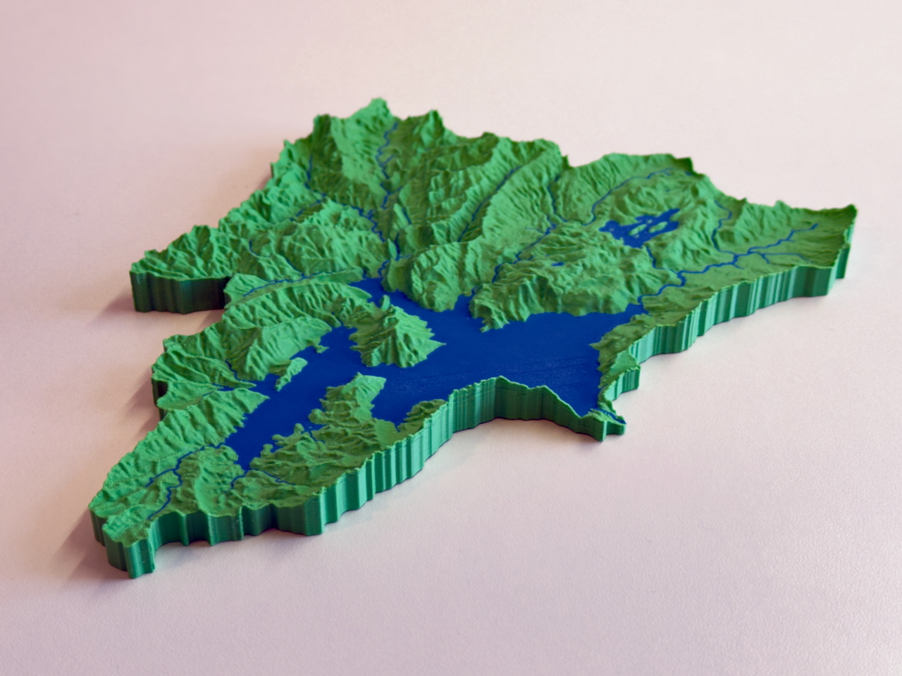
Lake Waikaremoana
3D model of the Lake Waikaremoana catchment, nestled deep in Te Urewera. Also not to be missed is Lake Waikareiti - which has an island, with a lake, inside a lake.
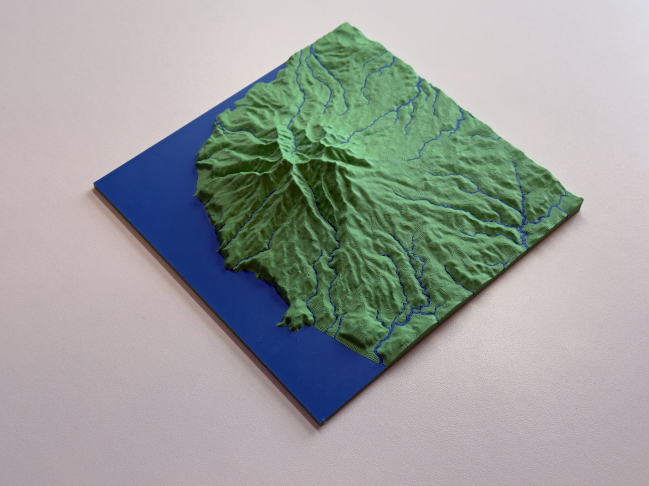
Mt Karioi
The striking Mount Karioi, 756m, near Raglan in the mighty Waikato.
Rotorua lakes
The Rotorua Lakes area has an abundance of lakes and geothermal features.
Sounds to Sounds
Sounds to Sounds is a 1500km bikepacking race from Marlborough Sounds to Milford Sound.
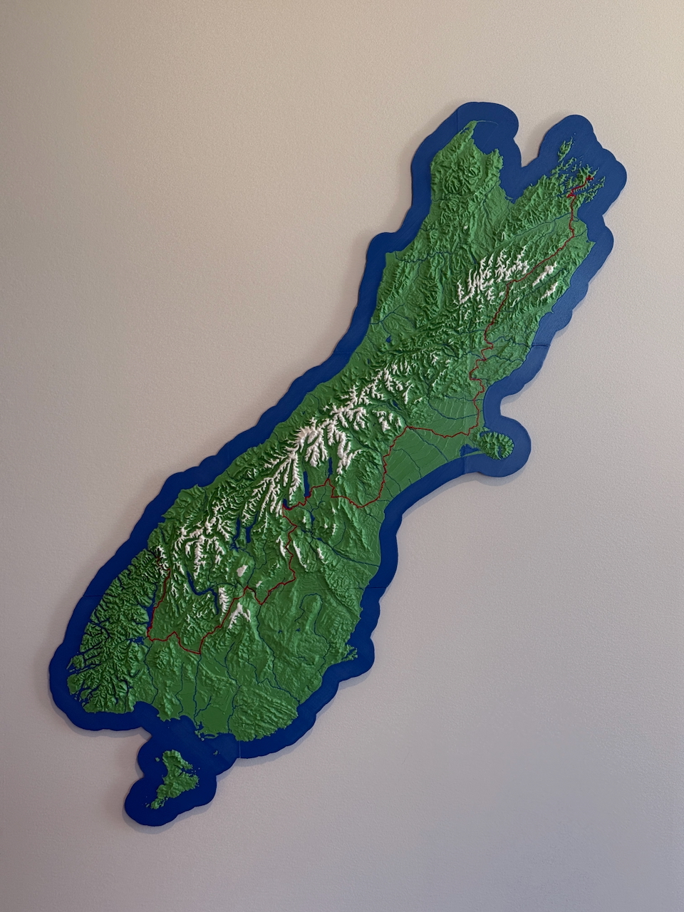
Waitaki catchment
3D catchment model of the Waitaki River, featuring large alpine lakes, braided rivers, and a snowline to accentuate the mountains.
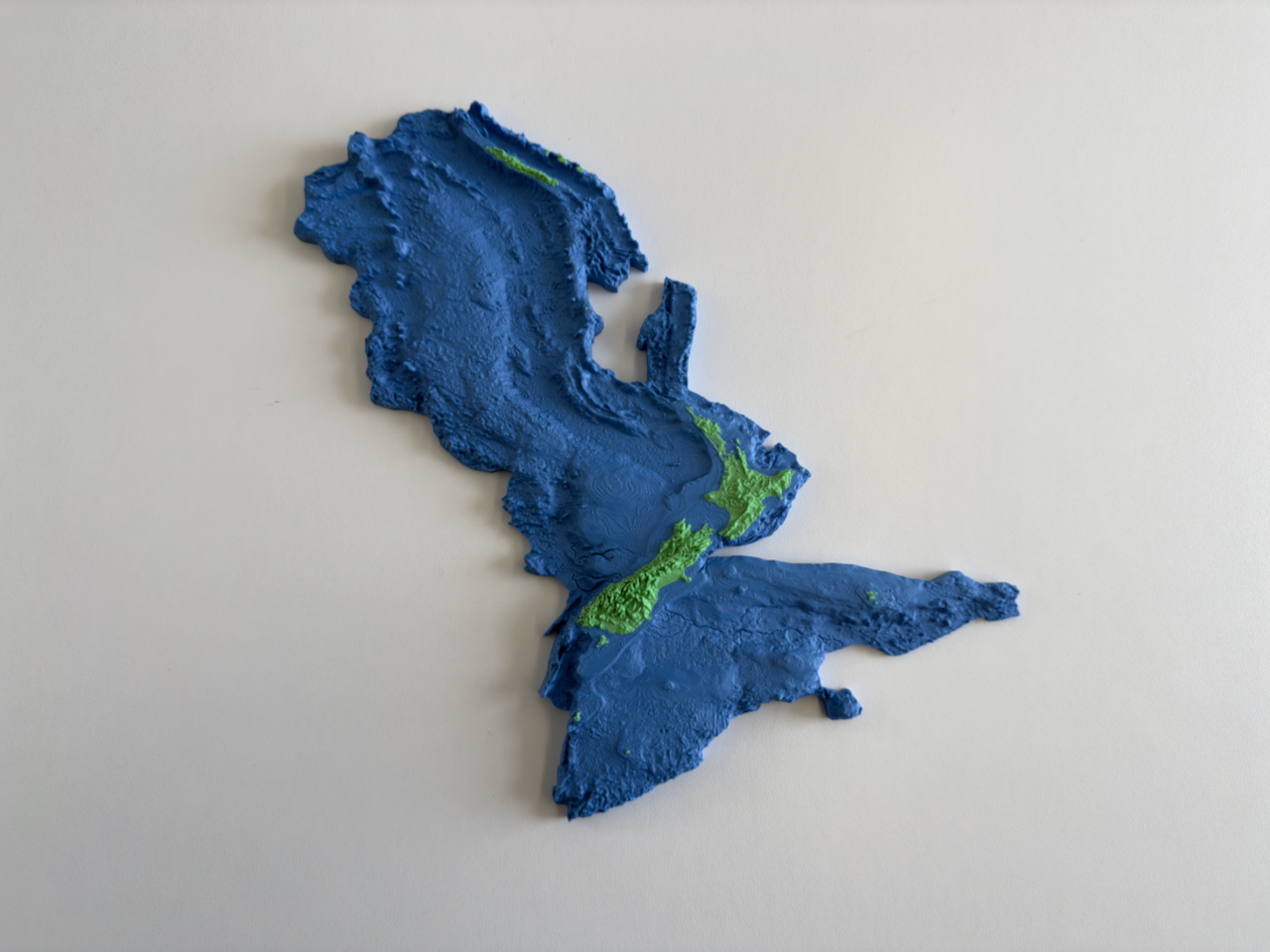
Zealandia
This combined topographic and bathymetric 3D model highlights the Earth’s eighth continent - Zealandia / Te Riu-a-Māui.
No matching items