3D-printed models for regional councils
3D-Printed Terrain Models for Regional Councils
At Kākāpō Industries, we partner with regional councils across Aotearoa to create highly detailed 3D printed models that support community engagement, environmental planning, and long-term stewardship of natural resources.
These models offer an innovative, tactile way to communicate spatial data, helping your teams better connect with stakeholders, whānau, and the wider public.
Why Use 3D Models for Engagement?
Conventional GIS maps and technical reports can be difficult for non-specialists to interpret. Physical 3D models create a bridge—transforming complex data into a format that is:
🧠 Intuitive – Easily understood by diverse audiences
👁️ Visual – Eye-catching and memorable in public spaces
📚 Educational – Ideal for workshops, hui, and exhibitions
They foster understanding of environmental challenges such as erosion, water quality, flood risks, and biodiversity loss—grounded in the actual terrain people live in.
Applications for Regional Councils
Our models are being used by councils for:
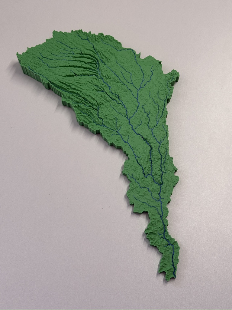
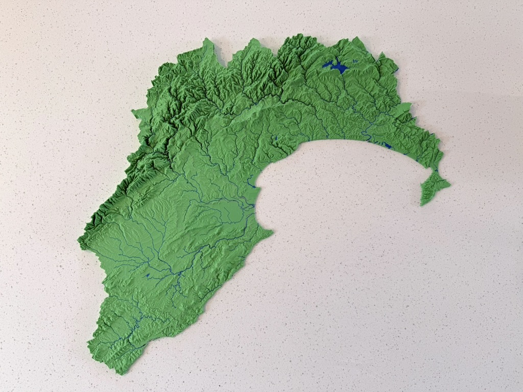
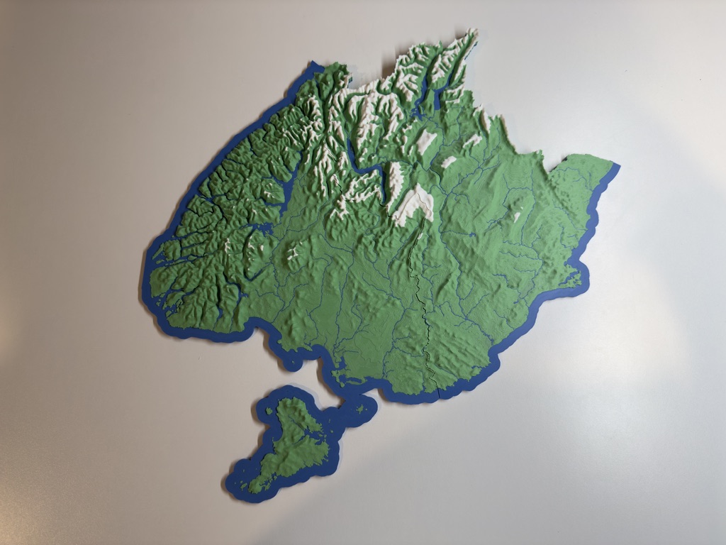
- Catchment Management: Showcasing sedimentation patterns, riparian areas, and hydrological flow.
- Land Use Planning: Illustrating proposed zoning, infrastructure, or conservation interventions.
- Climate Change Adaptation: Communicating the impacts of sea-level rise or flooding on local landscapes.
- Biodiversity Initiatives: Highlighting habitats, planting corridors, and ecological values.
What Sets Us Apart
We combine high-resolution GIS and LiDAR data with multi-colour 3D printing to create models tailored to your region and objectives. Every model is:
🗺️ Customised to match your spatial units (e.g. FMUs, catchments, zones)
🧩 Printable in modular pieces for easy transport and targeted engagement
♻️ Made with eco-friendly PLA from renewable plant-based sources
🏢 Suitable for consultation events, classrooms, and permanent displays
Freshwater management units
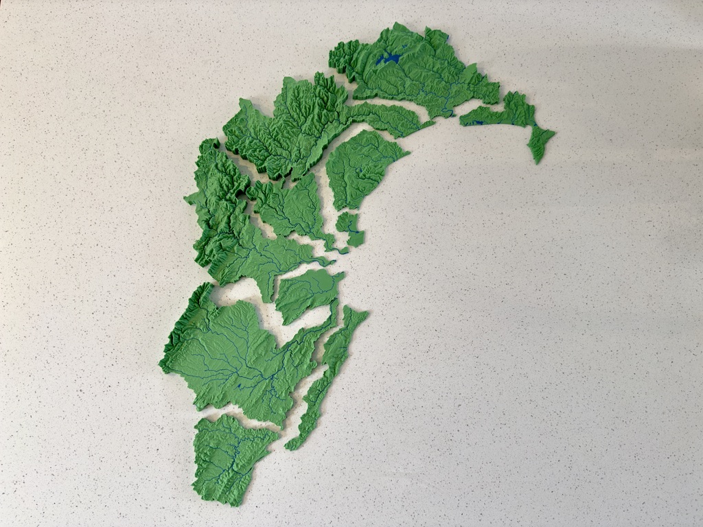
We specialise in producing multi-part terrain models, such as freshwater management units printed at the same scale. These can be pieced together like a jigsaw or taken individually to local workshops and community hui.
Let’s Work Together
Whether you’re preparing for a regional plan review, public consultation, or science communication initiative, our 3D models offer a powerful, people-friendly way to visualise place and process. Contact us to discuss your project. We’re happy to liaise directly with your GIS team, and can work with a wide range of formats and projections.